

We chose Panguitch as our home base for our time in Southern Utah. This is such a spectacular area with many options for camping. Panguitch is close to Utah’s Highway 12, which provides access to Red Canyon, Bryce Canyon, Grand Staircase – Escalante National Monument, Kodachrome Basin, and Capitol Reef National Park, among other stunning destinations. We lost two days of our planned stay due to the weather delay at Lake Powell, but we still managed to see quite a bit of this area. It is some of the most spectacular scenery in the country, no question about it.
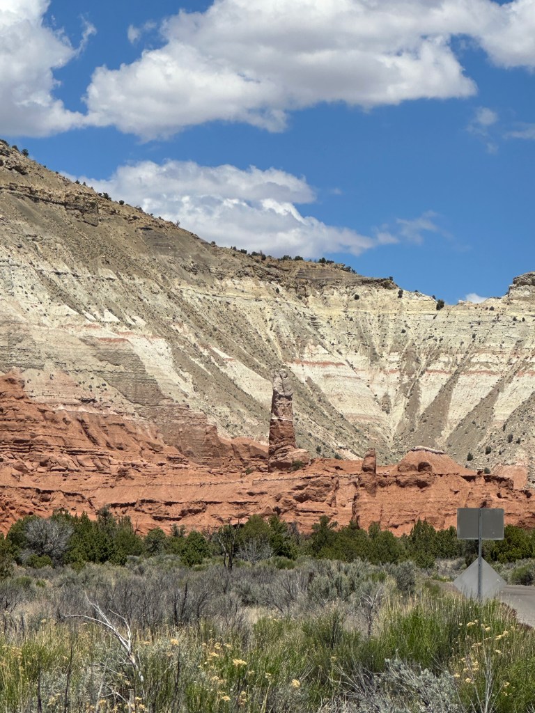
Before we look at the places we visited, it’s helpful to have some background on the Grand Staircase formation. This massive geological wonder extends from Bryce Canyon on the north to the Grand Canyon on the south. Zion Canyon National Park is considered the western boundary, and Capitol Reef National Park the eastern boundary. Grand Staircase – Escalante National Monument comprises much of the formation that exists within those general boundaries. The layers of sedimentary rock visible here form a massive “staircase” with the various layers easily distinguished by their predominant color. They once covered a much larger area, but much of it has been eroded away over time. Our National Park system preserves this critical piece of geological history for the world to observe, examine and enjoy.
Bryce Canyon

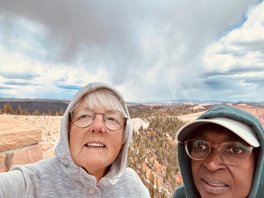
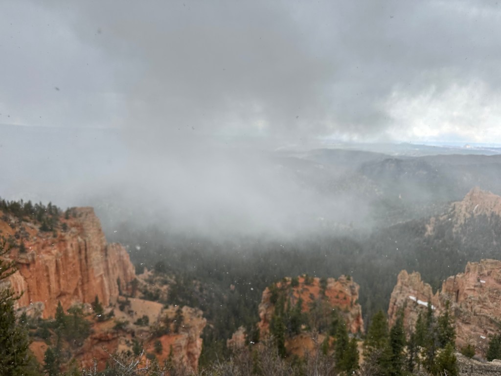
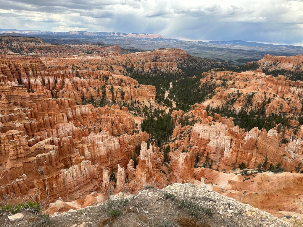
Bryce Canyon packs so much into such a relatively small space! Its wonders can be seen by driving to the scenic overlooks, or taking a shuttle between the overlooks in the “amphitheater”, or by hiking the amphitheater trails. Our preferred method would be to hike, but Gracie was not permitted on the non-paved trails, and the weather was not the best on some days. So we drove the length of the park one day, and did the amphitheater another day. Normally it’s difficult to drive between these stops as the parking at each one is limited and this popular park is often crowded, but we were there early enough in the season that it was possible to do it.
The Bryce Park Road
This 18-mile road extends the full length of the park from the park entrance to Rainbow Point. It’s recommended to drive to the end of it, view the overlooks there, and then view the remaining overlooks on the way back. Since all the overlooks will be on your right on the way back, it’s easier to get in and out of them in that direction.
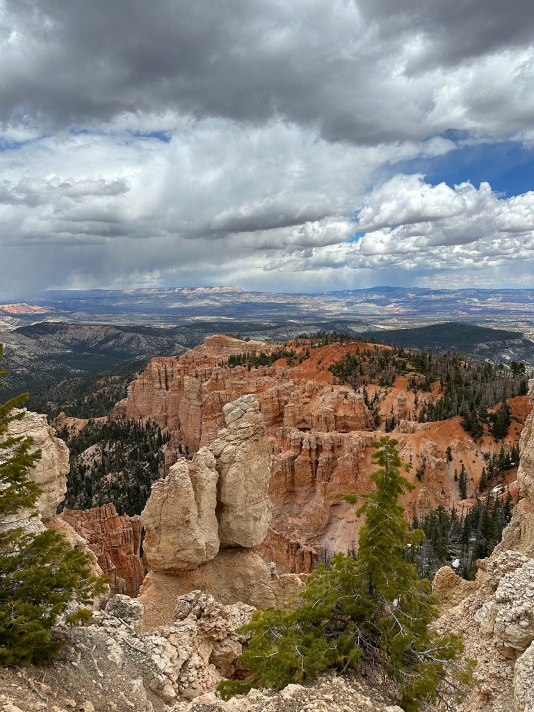
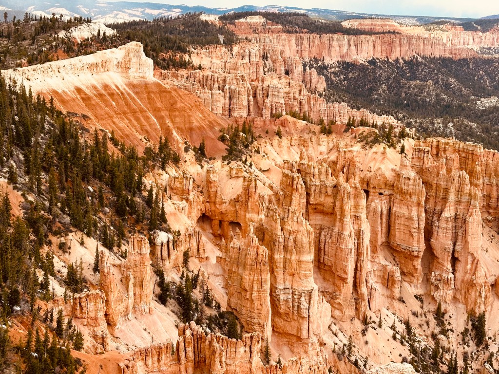

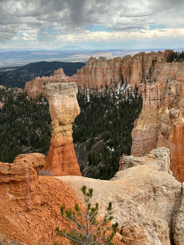
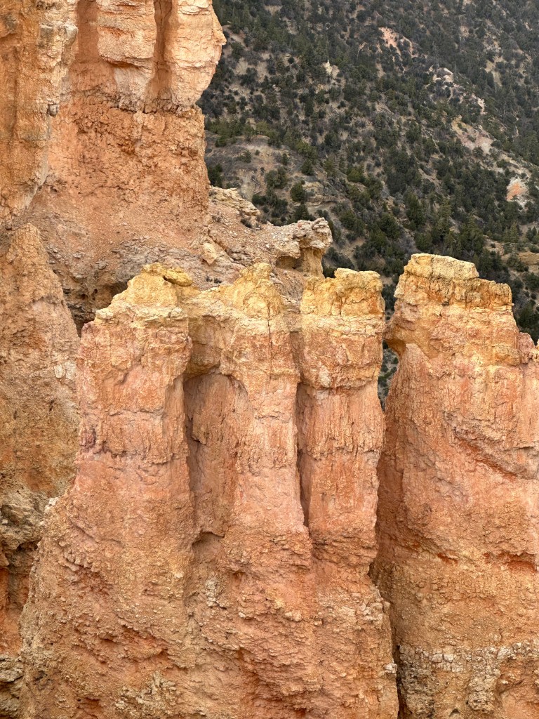

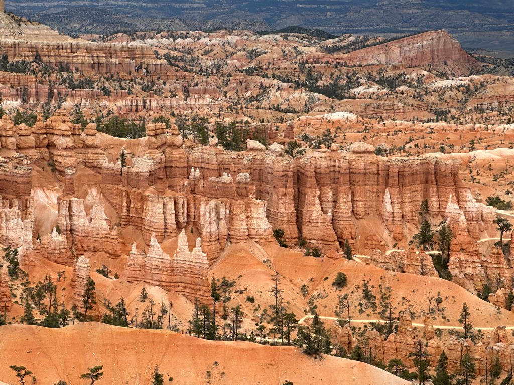
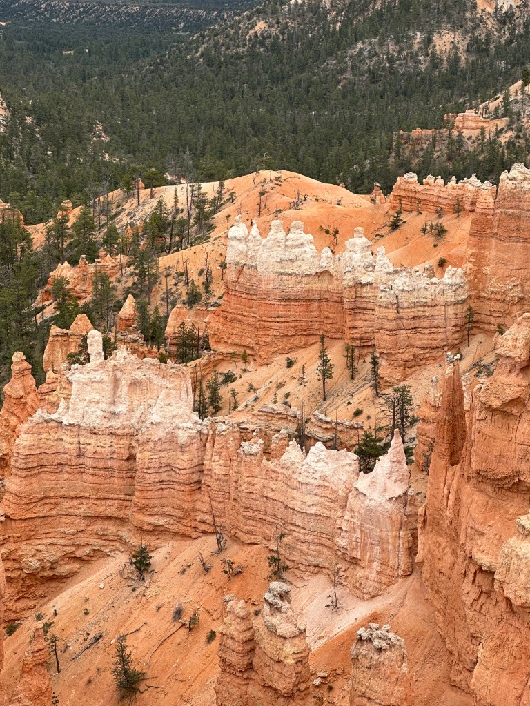
The Bryce Amphitheater
The amphitheater is a section of the park with many cliffs, walls, castles and hoodoos. There are several trails that meander through it, and the Rim Trail and Under-Rim Trail that run along its top edge. It has four viewpoints: Bryce, Inspiration, Sunset and Sunrise. We were lucky to be able to visit it by driving between the viewpoints. I would not recommend this during the summer!


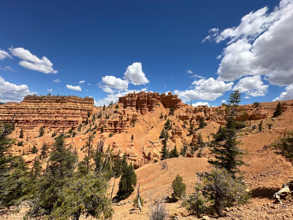
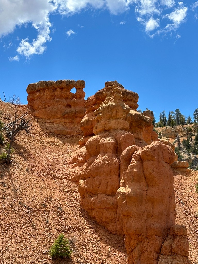
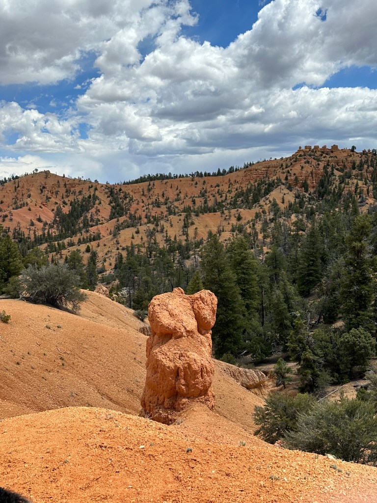
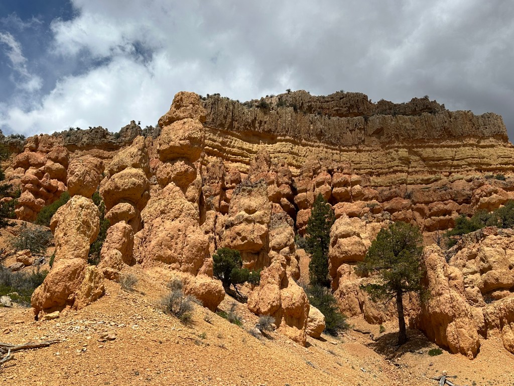
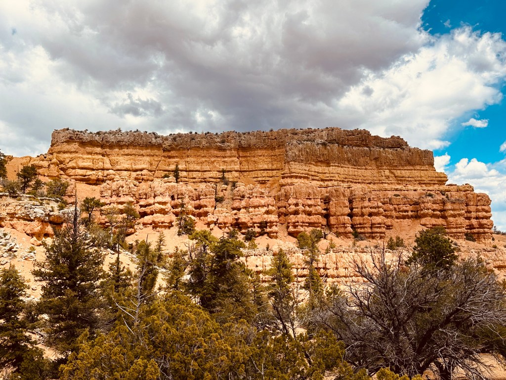
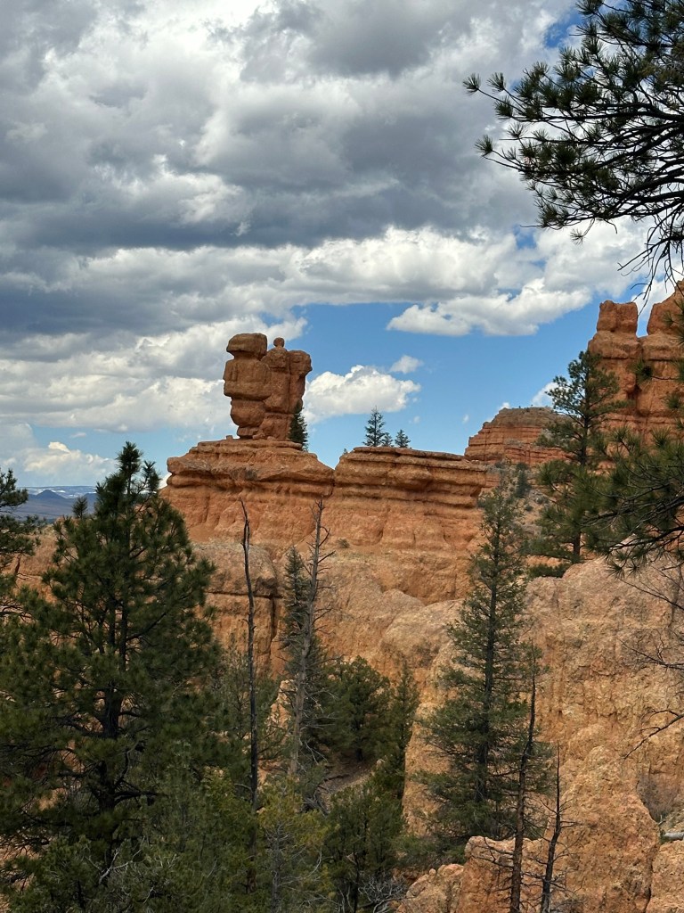
Red Canyon
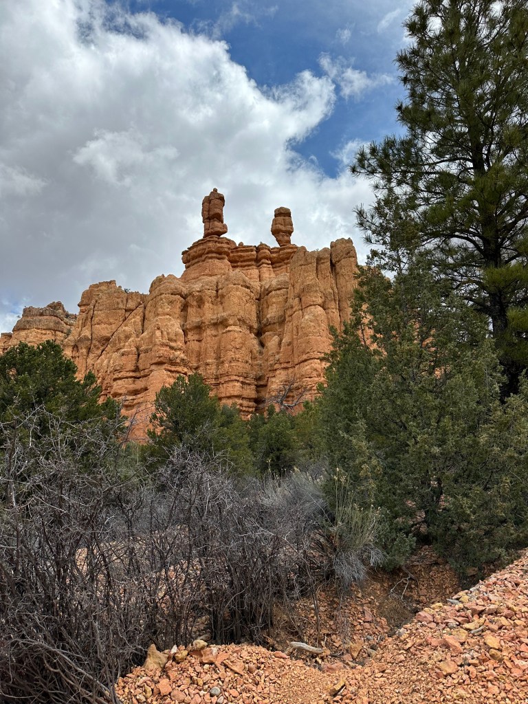
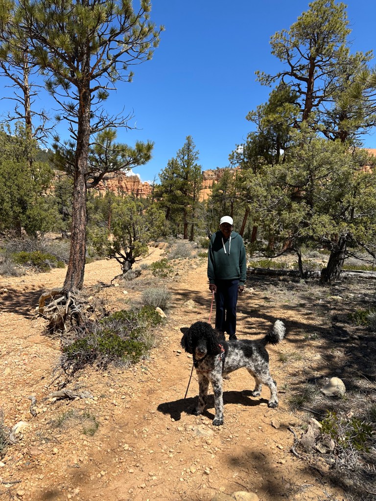
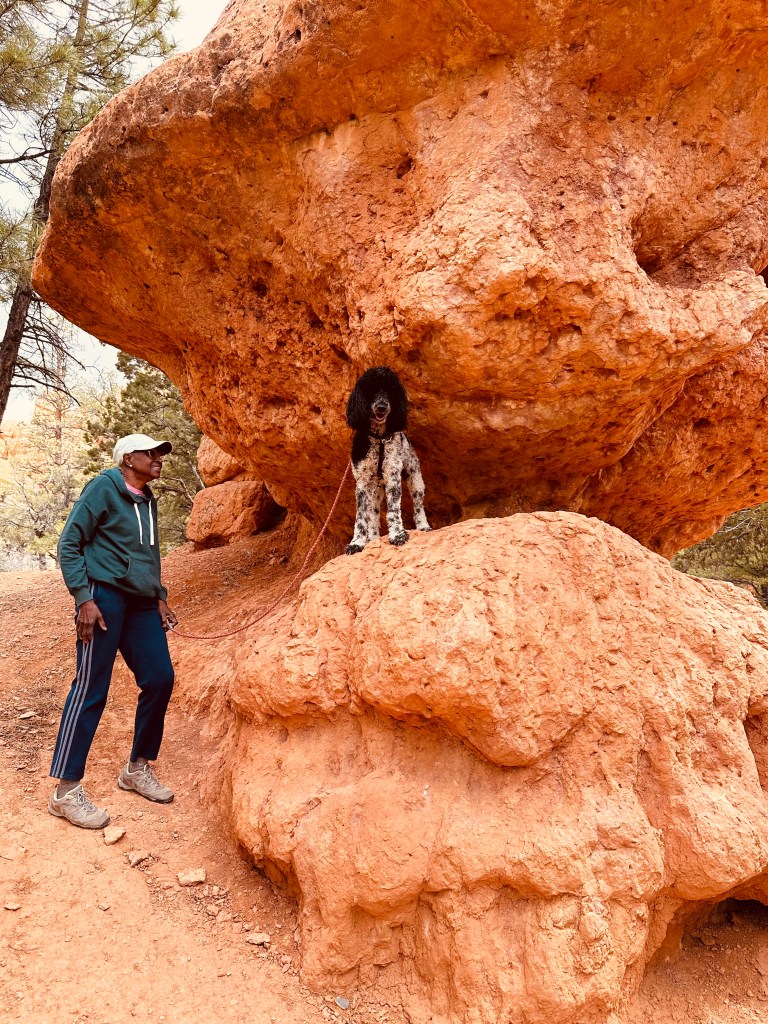
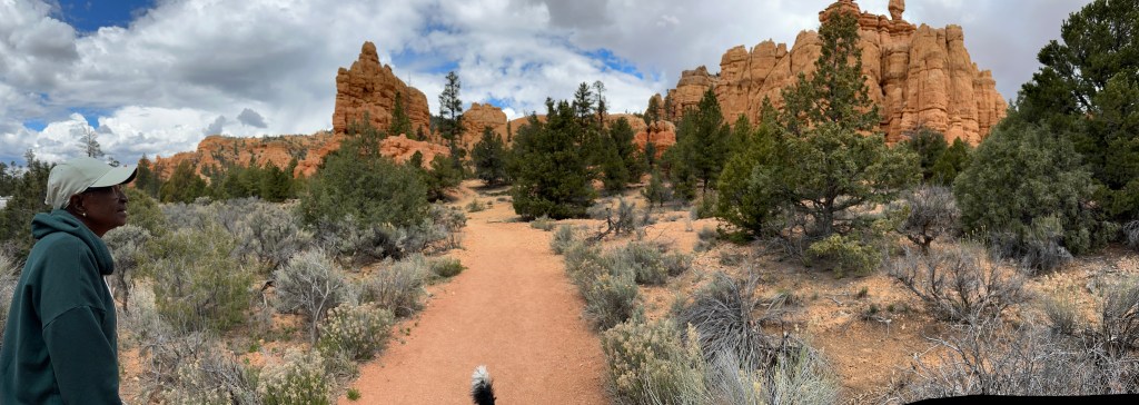
Red Canyon is a US Forest Service recreation area, not a National Park like Bryce is. It has beautiful geological formations, fantastic views, great hiking trails, and you can bring your dog with you on your hikes. It was also very close to our campground in Panguitch. It became a favorite destination during our stay in the area.
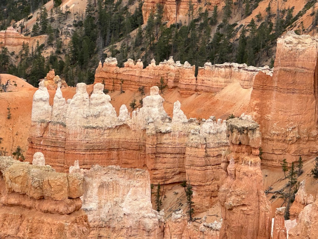
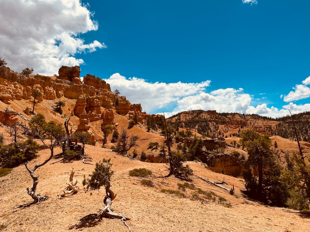
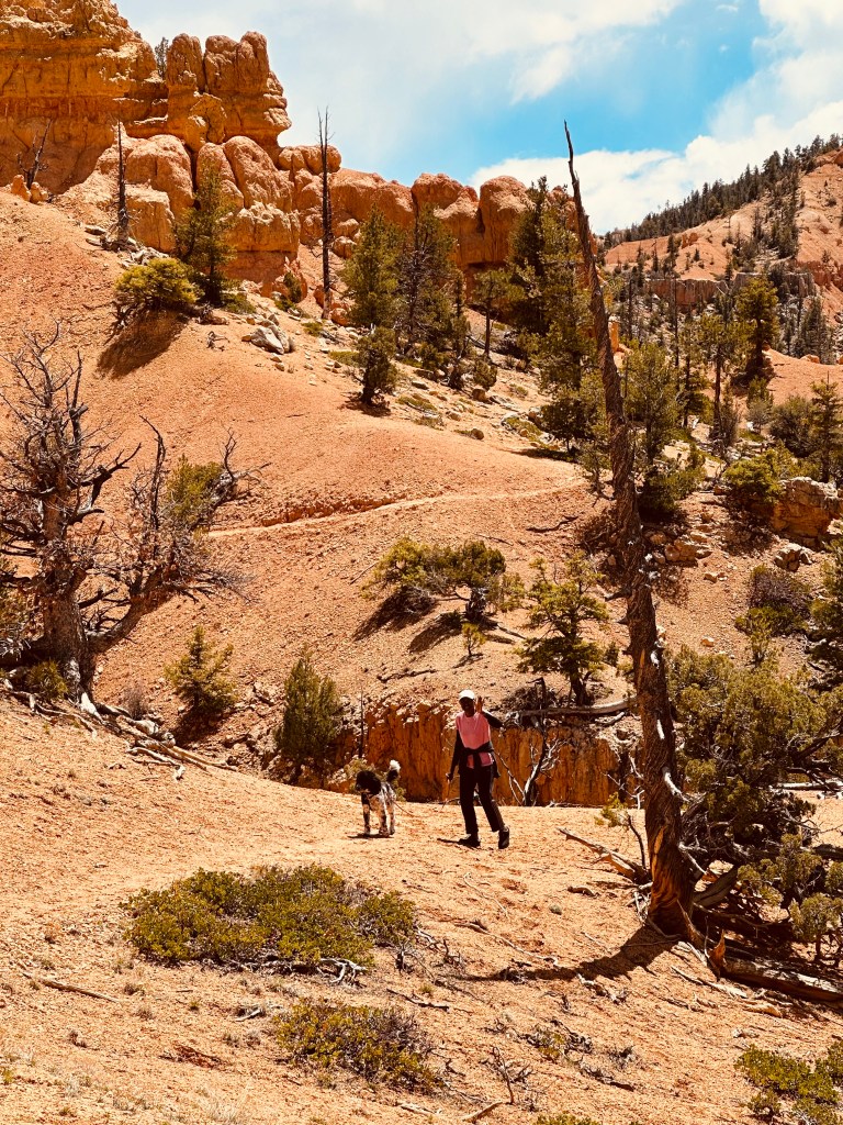
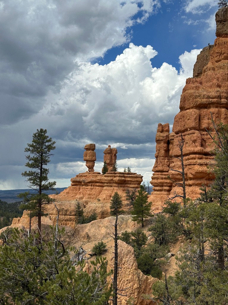
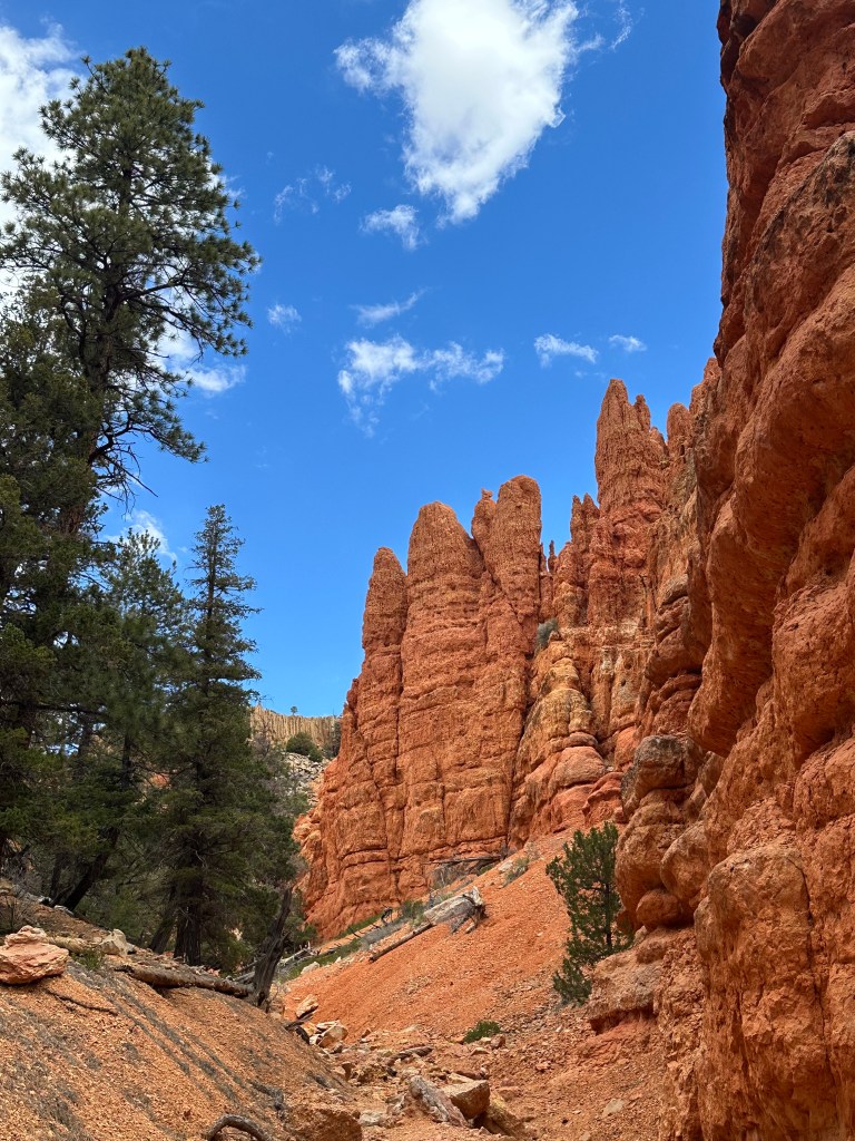
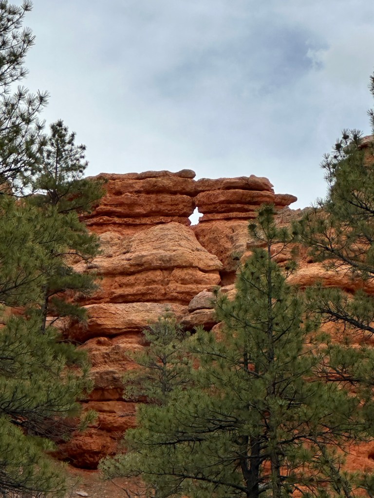
The Golden Wall / Castle Bridge / Buckhorn Loop
We spent a day hiking this loop. It’s a little over 4 miles long, with just over 1000 feet of elevation gain. The views are spectacular, the closeups to hoodoos are impressive, and it’s just a wonderful day out on the trail. Be advised – the Forest Service visitor center where maps would ordinarily be available was not open at any time during our visit. The AllTrails app for iPhone (and probably Android) has this trail in its collection. Download the map before you head out to keep yourself on track during your hike.
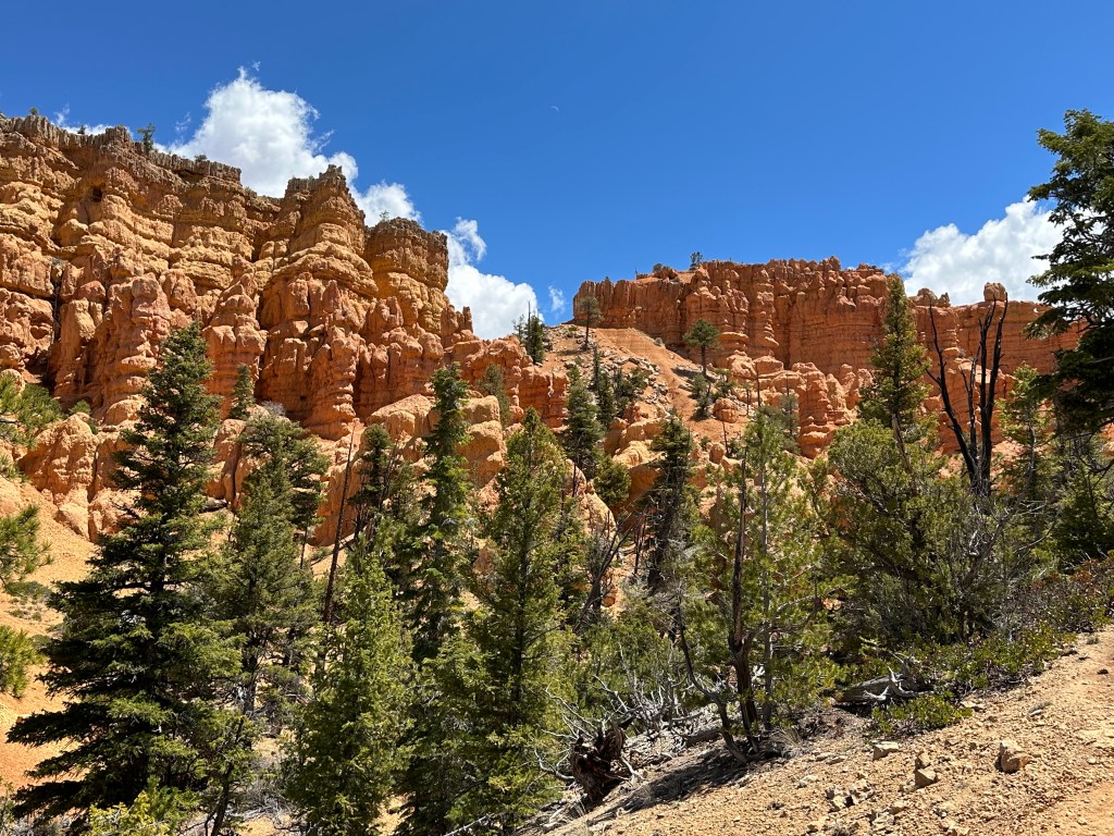


The next section of the hike featured a garden of cliffs and hoodoos in sometimes startling arrangements.
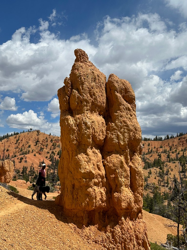


By the time we returned to the parking lot to pick up our truck, we were feeling like we’d had a long day out on the trail. But a very satisfying one!
Birdseye, Pink Ledges Trails
These shorter trails begin in the area of the visitors center. They can be explored in an hour or so, and offer some nice views. We had planned a longer trek on them but saw the rain moving in and decided to stick to the lower elevations. It was still a nice hike!
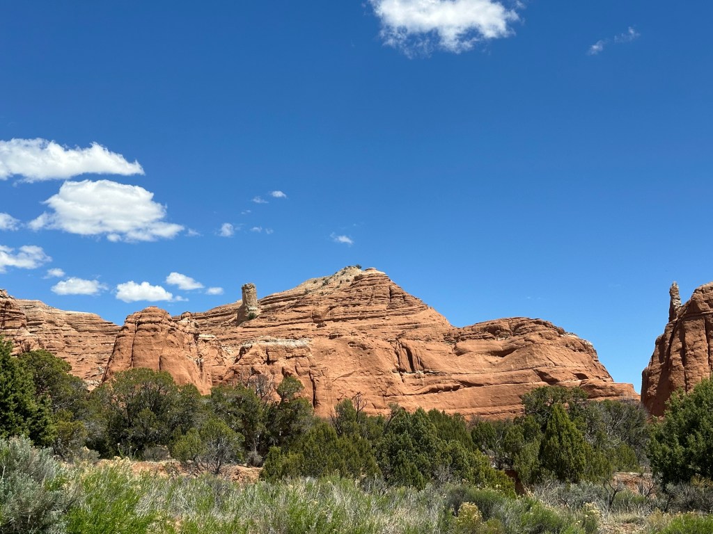
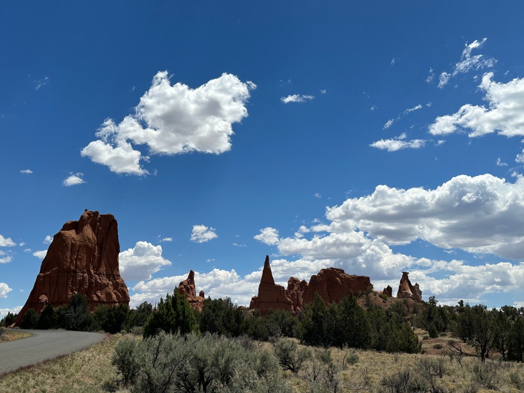
Kodachrome Basin

This is a Utah State Park with an intriguing name! You might think you would see some colorful scenery here, and you would be right.
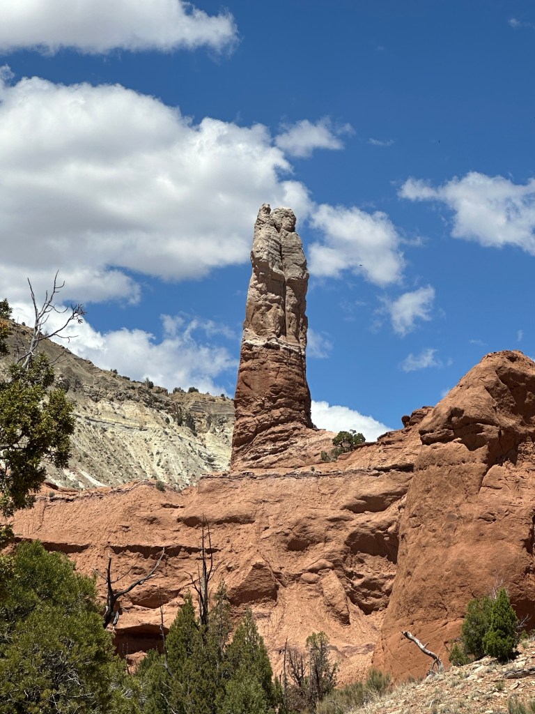
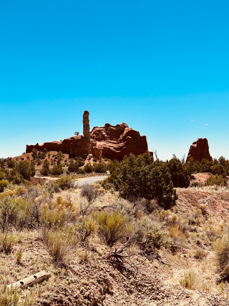
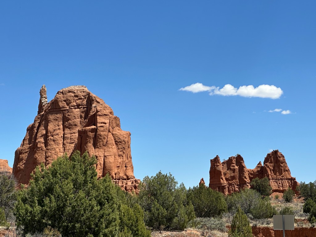
In addition to beautiful views and impressive rock formations, Kodachrome Basin has a nice little visitors’ center. We stopped by on our way out to relax in the hammock chairs and sample some of the killer ice cream they serve up. The staff were even happy to give us a little cup of vanilla for Gracie, who was thrilled! This park is well worth a visit!
Tip – there is very little shade here, and on a hot day this park can get very warm. Bring plenty of water, and schedule your visit in the early morning or late afternoon if possible.

Leave a reply to bkelly119 Cancel reply